Earlier Burial Places
Prior to the establishment of the current cemetery, burials occurred at a number of other locations in the area, usually close to the place of death. Burial sites have been identified at the first St John’s Church (near Mona Vale Headland), Bayview, Coasters Retreat, The Basin, Lovett Bay (Floods Peninsular), Careel, Snapperman Beach (in the vicinity of Sandy Beach), Station Beach (western edge of Governor Phillip Park, Palm Beach), Barrenjoey Lighthouse and Church Point Cemetery. Some of these were lone graves. There was a cemetery gazetted in 1891 on the corner of Barrenjoey Rd and Mona Street (now Golf Ave), called Narrabeen Cemetery but it appears to have not been developed. (Research by Bob Pauling)
The Early Days
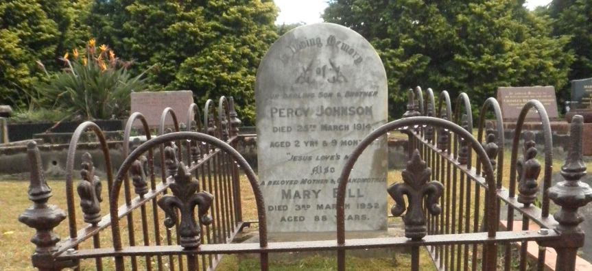
Mona Vale’s Cemetery was established in 1905 and the first marked grave is for Percy Johnson, aged 2, who died in 1914. A Board of Trustees representing local churches were appointed to administer the Cemetery at that time. But by 1926 the Cemetery was neglected and the local community urged Warringah Shire Council to take over its management. The Catholic Church maintained control of their portion of the Cemetery until 1984. Originally bereaved families would report to the local police station to report a death, and would make their own arrangements for the funeral and burial.
After agreement with the Trustees, Warringah Shire Council took over the management of the cemetery from 31 May 1929. However this trusteeship was later revoked and another board was appointed until 16 October 1956, after which Warringah Shire Council was reappointed.
When Pittwater seceded from Warringah Shire Council on 1 May 1992, Pittwater Council took over the management of the Cemetery and was officially appointed Trustee in 2004.
Read more on the history of the Cemetery
Present Day
The Northern Beaches Council has now taken over the management of the cemetery although this change is yet to be gazetted. There are now over 7000 burial sites and over 2000 cremation memorials in the cemetery. A Conservation Management Plan for the cemetery was completed in 2016.
The cemetery is approaching full capacity and there are limited burial sites available. However Council has been able to expand the range of cremation memorials and also has a wall for memorials to those whose remains have been scattered elsewhere. This ensures a record of that person (and what happened to their remains) survives in perpetuity.
Mona Vale Cemetery - Planning for the Future
A draft Plan of Management for the cemetery was approved in 2012 and adopted by the Department of Primary Industries, Crown Lands Division in September 2013. The Plan allows for the creation of new burial sites and a wider range of cremation memorials. The Cemetery will expand into land adjacent to Mona Vale Road and the closed section of Walana Crescent. The cemetery will continue to operate for many years to come, catering for cremation memorials, as well as first and second in burials in already reserved burial sites.
Historical Walking Tour
An online walking tour of Mona Vale Cemetery was developed to commemorate the centenary of the cemetery. View the map
Council would like to acknowledge the NSW Government Heritage Near Me program and the assistance of the following people and organisations in the preparation of this tour:
- Manly, Warringah and Pittwater Historical Society
- Ken Munday and Rod Liao – Stone Orchard Cemetery Software
- Andrew Morgan, Cemetery Caretaker
- Others as noted on individual submission.
 | Developed with assistance from the NSW Government Heritage Near Me program |
